
Efficient Vineyard: Making Sense of Sensors
By Dr. Terry Bates, Cornell AgriTech, School of Integrative Plant Science, Cornell University
The end goal for the SCRI Efficient Vineyard (EV) project is to achieve “spatial-data-driven variable-rate vineyard crop-load management.” It is a mouthful of a statement! Basically, it means that we gather spatial data from sensors, translate it into information, calibrate it against desired outcomes and layer all of that into a prescription map of the vineyard that reveals its non-uniformity. We enable those maps to “talk” to the mechanized tractor-based tools you use so that they automatically adjust in response to the non-uniformity of the site. Thus, we can manage that vineyard such that it produces the quality and/or quantity of fruit desired, consistently, across the whole vineyard, mechanically. In short, we are putting sensors to work.
What is this technology good for? No two vineyards are the same, and no two vineyard managers are the same. This project has worked in wine, table and juice grape vineyards, in different growing regions and with varying vineyard economic goals. It has been interesting to see how different vineyard managers approach precision viticulture technology. Because there is no “one size fits all” solution, we oriented the EV project to a measure-model-manage approach. That means, what you measure spatially, such as soil, canopy or crop characteristics; what level of complexity you can or want to achieve with your spatial data modeling (e.g., block by block, row by row, or vine by vine); and what attribute(s) you choose to manage in the vineyard, either manually or mechanically, is at your discretion.
Using spatial data to prove you don’t need spatial data? One of the most powerful uses of spatial sensor data has been evaluating the spatial dependency of vine growth, production or fruit quality within a vineyard. The evaluation itself indicates if there is potential for variable rate management to improve vineyard uniformity. If a vineyard is already relatively uniform or is highly variable but the variation cannot be tied to some manageable spatial structure, say in soil or yield pattern, then there is really not much sense in investing further in precision viticulture technology. It may be counterintuitive, but the technology can be used to show that you don’t need the technology. In contrast, when the sensor data exhibit a high degree of spatial dependency, say there is a strong soil pattern driving vine growth and yield differently in different parts of the vineyard, then the potential of precision viticulture technology and variable rate management to improve vineyard uniformity increases.
Making sense of sensors. Nature is inherently heterogeneous. But most growers are trying to produce uniform vine growth and fruit quality despite the variation. Spatial sensor data allow us to define that natural variation and manage against it.
The EV project uses electronic, reflectance, image and physical sensors to measure various aspects of vineyard soil, canopy, crop or juice quality. The catch is that all of these sensors operate as an indirect or relative indicator and not a direct measure of vineyard attributes, such as yield or vine size. Sensor calibration to your vineyard attribute of choice—cluster weight, berry color, you name it—is critical to translating sensor signals into viticulture information. The EV project routinely uses spatial-data-directed sampling over random vineyard sampling to ensure the translation tracks with your intentions. From there, we integrate the data to form a management plan.
All validated spatial vineyard data are processed in a way that allows for both visual and mathematical comparison. “In this vineyard, are there relationships between the soil pattern, water availability, canopy growth, yield, and juice soluble solids? Which relationships are strongest? Why does section X not follow the same relationship? Should we consider managing that section differently (a.k.a., differential or variable rate management)?”
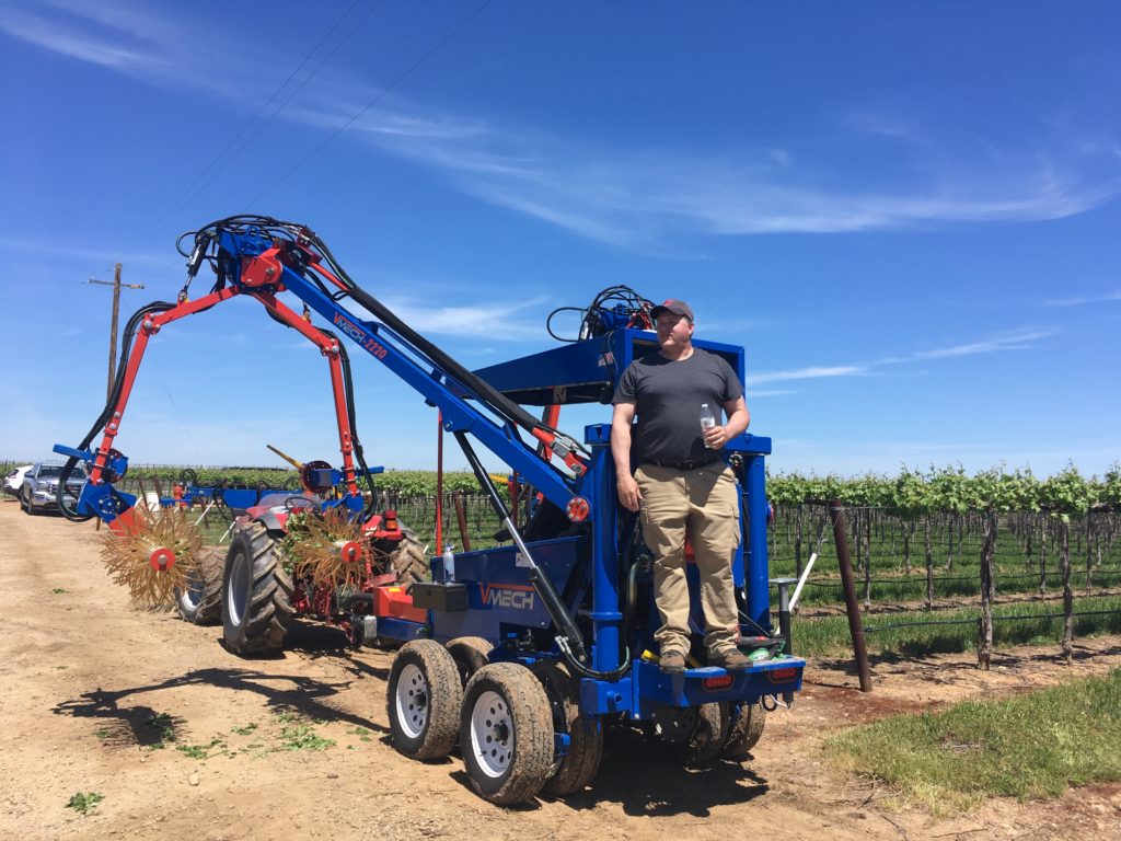
Armed with this data, we create digital prescription maps to manage for the variation. Commercially available precision agriculture hardware/software is used to read the prescription shapefiles (a popular file format for geospatial data) and control the mechanized tractor-mounted implements through variable-rate hydraulic flow. What does this look like in the field? The vineyard employee simply drives the tractor while the technology applies the variable rate management automatically. The outcome is a very efficient vineyard.
The SCRI-funded Efficient Vineyard project concludes this fall, so the big question is, have we succeeded on our end goal, to achieve spatial-data-driven variable-rate vineyard crop-load management? Absolutely. We have used both variable rate mechanical shoot thinning and fruit thinning to improve spatial vineyard balance in project vineyard plots. Doing so has required multiple sensor technologies, new sampling strategies, spatial data processing, vineyard management integration, precision agriculture hardware and software, and variable-rate capable vineyard equipment. In true research fashion, the future of vineyard management has been duct-taped together, both literally and figuratively, from commercially available hardware, new prototype sensors, multiple software and freeware platforms, and modified mechanized vineyard equipment. The remaining challenge will be to develop this technology for practical commercial application. Hopefully, more to come on that!
Some notable benchmarks
Over the course of the EV project, we have achieved a number of milestones. Here are a few, broken down by our measure-model-manage approach:
Measure:
- Successful use and validation of proximal commercial soil and NDVI sensors in juice, wine and table grape vineyards.
- Development of a non-destructive imaging platform for vine yield components: dormant vine size and bud count (sprawl and VSP trellises), early-season shoot count (sprawl and VSP), mid-season berry count and size (VSP), and pre-harvest fruit color (table grapes).
- Side-by-side comparison of yield monitors from ATV and OXBO.
- Development of on-the-fly juice soluble solids sensing during mechanical harvest.
Model:
- Tested protocol for multi-layer spatial data processing and comparison.
- Generated spatial crop load maps (Ravaz Index maps) based on yield and vine size in commercial Concord vineyards.
- Continued development on GeoVit, an open-source spatial data processing platform for vineyards.
Manage:
- Improved mid-season crop estimation with spatial-data-directed destructive sampling or with non-destructive berry image analysis compared against traditional random sampling.
- Integration of prescription shapefiles with commercially available precision agriculture hardware/software, liquid flow controller, variable hydraulic valve and vineyard mechanization equipment for variable-rate applications.
- Demonstrated mechanical crop load management in commercial vineyards through variable-rate shoot thinning or fruit thinning.
The Efficient Vineyard project is supported by the National Grape Research Alliance and the USDA-NIFA Specialty Crop Research Initiative Award No. 2015-51181-24393. Project PIs: Terry Bates (Cornell University), George Kantor (Carnegie Mellon University), James Taylor (IRSTEA), Julian Alston (UC Davis), and Tim Weigle (NYS IPM/Cornell CCE). www.efficientvineyard.com